

Sgurr Choinnich [Sgurr Choinich]
Good walks are even better shared.
NN1295 : North face of Sgurr Chòinich
Richard Webb Photo source
Overview
Sgurr Choinnich: A Hiker's Delight
Nestled in the heart of the Scottish Highlands, Sgurr Choinnich stands tall at 914 meters. A true Munro, it beckons hikers with its stunning views and exhilarating climbs. Whether you’re a seasoned mountaineer or a first-timer, this mountain has something for everyone.
Geology
Sgurr Choinnich is predominantly made up of Lewisian Gneiss, a rock type that has survived the passage of time and geological upheaval. Its rugged landscape is a testament to the ancient forces that shaped Scotland’s highlands. Look closely, and you might just spot some glacial striations that tell the tale of a bygone era!
Routes
The most popular route begins in Glencoe Valley. Spanning 12.5 km, this moderate hike usually takes around 5.5 hours to complete. The trail is well-defined but do keep an eye out for those cheeky boggy sections that may try to trip you up!
Summit Features
At the summit, you’ll be greeted by a pile of stones forming a prominent cairn. This spot is perfect for taking in the vast landscape and, of course, snapping some stunning photos. Remember, it’s called a ‘cairn’, not a ‘care-in’, so keep your sandwiches secure!
Terrain Type
Expect a mix of rocky and grassy trails, interspersed with sections that are a bit on the boggy side. Proper hiking boots are essential, as flip-flops are unlikely to cut it here!
Views
One of the major highlights from Sgurr Choinnich is the breathtaking sight of Buachaille Etive Mor and Loch Awe shimmering in the distance. The best seasons for views are spring and early autumn, when the landscape is dressed in vibrant hues.
Hazards
Do keep in mind the potential hazards, such as loose rocks and sudden changes in weather. It might be sunny one moment, only for the clouds to roll in and rain on your parade!
Nearby Summits
For those looking to extend their adventure, Sgurr Choinnich is not far from other peaks like Sgurr na h-Ulaidh and Bidean nam Bian, both of which will surely challenge your hiking prowess.
Access
Accessing the mountain is straightforward, with the nearest car park located at the base of Glencoe Valley. Public transport options are available from Fort William, and the quaint village of Kinlochleven offers a few amenities if you need a bite to eat after your trek.
History
The etymology of Sgurr Choinnich adds a fascinating layer to your hiking experience. While the name suggests a rather noble dog, it might just be an insider joke among the locals. Historically, the mountain has attracted adventurers and climbers for over a century, remaining a beloved choice for outdoor enthusiasts.
Conclusion
So lace up your hiking boots, prepare your favourite snacks, and set out for an awe-inspiring day on Sgurr Choinnich. With its challenges and views, you're in for an unforgettable experience that might just have you returning for more mountain mischief. Happy hiking!
Explore routes near Sgurr Choinnich [Sgurr Choinich]
Walks starting near this hill. Open a route to check its map, distance and full itinerary.
Banavie to Glen Loy Aqueduct: Neptune’s Staircase Canal Towpath
View route
Ben Nevis via Mountain Path
View route
Fort Augustus to Kytra Lock: Caledonian Canal Towpath
View route
Great Glen Way low route: Fort Augustus to Invermoriston Old Bridge
View route
Route planning notes
These notes describe possible approaches. Check a route's map and access information when planning your walk.
Glencoe Start
A scenic route starting from the Glencoe Valley, with beautiful views and a moderately steep ascent to the summit.
Make a day of it, together
Find someone to share the walk with, or organise a day out along a route you like.
Photo Gallery
View all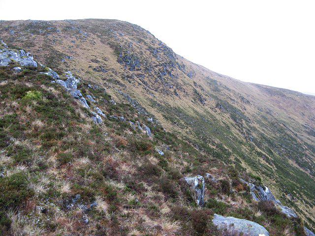 Photo could not load
NN1295 : North face of Sgurr Chòinich
Richard Webb
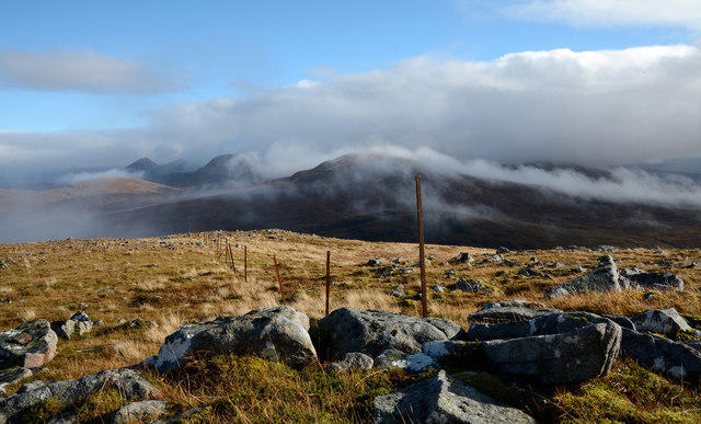 Photo could not load
NN1294 : Fence post line crossing Sgùrr Chòinich
Trevor Littlewood
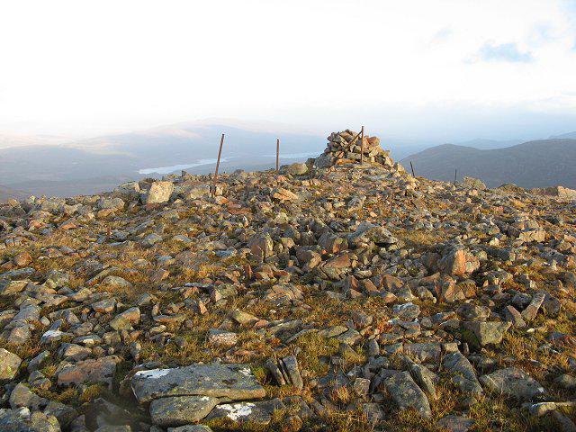 Photo could not load
NN1294 : Summit, Sgurr Chòinich
Richard Webb
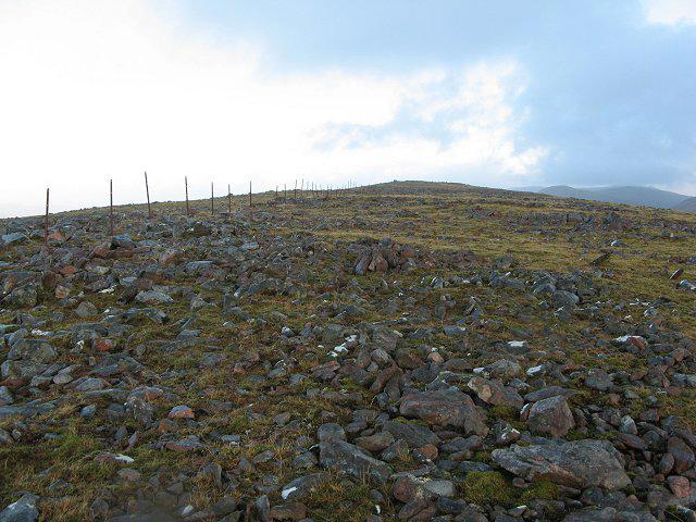 Photo could not load
NN1294 : Sgurr Chòinich
Richard Webb
Hill facts and local notes
Classifications
Elevation
749m
2,457 ft
Prominence
277m
Coordinates
57.0078, -5.0849
NN127949
OS Map
34
Explorer: 399
At the Summit
The summit features a prominent cairn and offers a splendid view of the surrounding peaks, making it the perfect spot for a selfie or two. Just try not to drop your sandwich!
Terrain & Geology
Primarily composed of the rugged Lewisian Gneiss, Sgurr Choinnich showcases the ancient geological processes that formed the Scottish Highlands millions of years ago. If rocks could talk, these would have stories to tell about the Earth's history!
Views & Scenery
From the summit, sightseers can admire the majestic Buachaille Etive Mor and the tranquil expanse of Loch Awe in the distance.
History & Heritage
Name Origin
The name 'Sgurr Choinnich' is derived from Gaelic, roughly meaning 'peak of the dog', which begs the question—was it a particularly impressive dog?
Historical Significance
This mountain has been a popular destination for mountaineers since the early 20th century, offering a blend of adventure and spectacular scenery.
Getting There & Facilities
Parking
Car park located at the foot of Glencoe Valley, approximately 1 km from the trailhead. Facilities may be limited, so bring your own snacks!
Public Transport
Regular bus services run from Fort William to Glencoe. Check schedules for seasonal variability.
Nearby Facilities
There are a few cafes and shops in Kinlochleven where you can refuel post-hike—don't forget that slice of cake!
Safety Information
Known Hazards
- Loose rocks, sudden weather changes, and uneven terrain. Always watch your step, as the mountain has its own sense of humour!
General Safety Tips
- Check weather conditions before setting out
- Carry appropriate clothing and equipment
- Let someone know your planned route
- Take a map, compass, and GPS device
- Carry emergency supplies: food, water, first aid kit, torch
Hills
Some common questions about the hills answered
Are there group walks up Sgurr Choinnich [Sgurr Choinich]?
Many walkers use Walkmates to join or organise walks with others. You can check for group walks around Sgurr Choinnich [Sgurr Choinich] through the maps
Are there other walkers around Sgurr Choinnich [Sgurr Choinich]?
Activity varies by location and time, but Walkmates lets you see whether others have shared walks or shown interest in this area. Find other people through the walking friends search walking friends for Sgurr Choinnich [Sgurr Choinich] search or of course create your own walk for Sgurr Choinnich [Sgurr Choinich]
Can I organise a walk to Sgurr Choinnich [Sgurr Choinich]?
Yes. If there aren’t any walks listed already, you can create a walk and make it available for others to join.
If you're signed up to Walkmates, you can create a walk to Sgurr Choinnich [Sgurr Choinich].
How do I find a walk up this hill?
There are often multiple ways to walk this hill, depending on experience and route preference. Walkmates helps you explore walks and routes that others have shared.
Can I suggest a new route up Sgurr Choinnich [Sgurr Choinich]?
Yes. You can suggest or create routes to share with others. Walkmates focuses on the social side of walking, so routes are used to help people organise walks and explore areas together, rather than as detailed navigation tools or route libraries.
Other uses really appreciate knowledgeable walkers sharing their routes. Share your favourite route to Sgurr Choinnich [Sgurr Choinich] here
The is an error or something incorrect about this hill. How do I let you know?
We always strive to keep the information on Walkmates as accurate as possible. If you find an error, please let us know through the contact form and we'll aim to correct it as quickly as possible
Community Discussion
Comments
Location
![Sgurr Choinnich [Sgurr Choinich] location map](https://cdn.walkmates.com/hill-maps/hill-sources/768/57.00776_-5.08490.png)
Grid reference: NN127949
View on OpenStreetMapOpens a map in a new tab, centred on the hill.
Nearby Hills
Gleouraich
1,035m
Carn Mor Dearg
1,221m
![Ben Nevis [Beinn Nibheis]](https://cdn.walkmates.com/gallery-images/44e34d25abc849e78f7b99a97863fffb.jpg)
Ben Nevis [Beinn Nibheis]
1,345m
Aonach Mor
1,220m
Aonach Beag
1,234m
No comments yet. Be the first.